CAD & Technical Drafting · 2026
Reference Plan Creation - AutoCAD
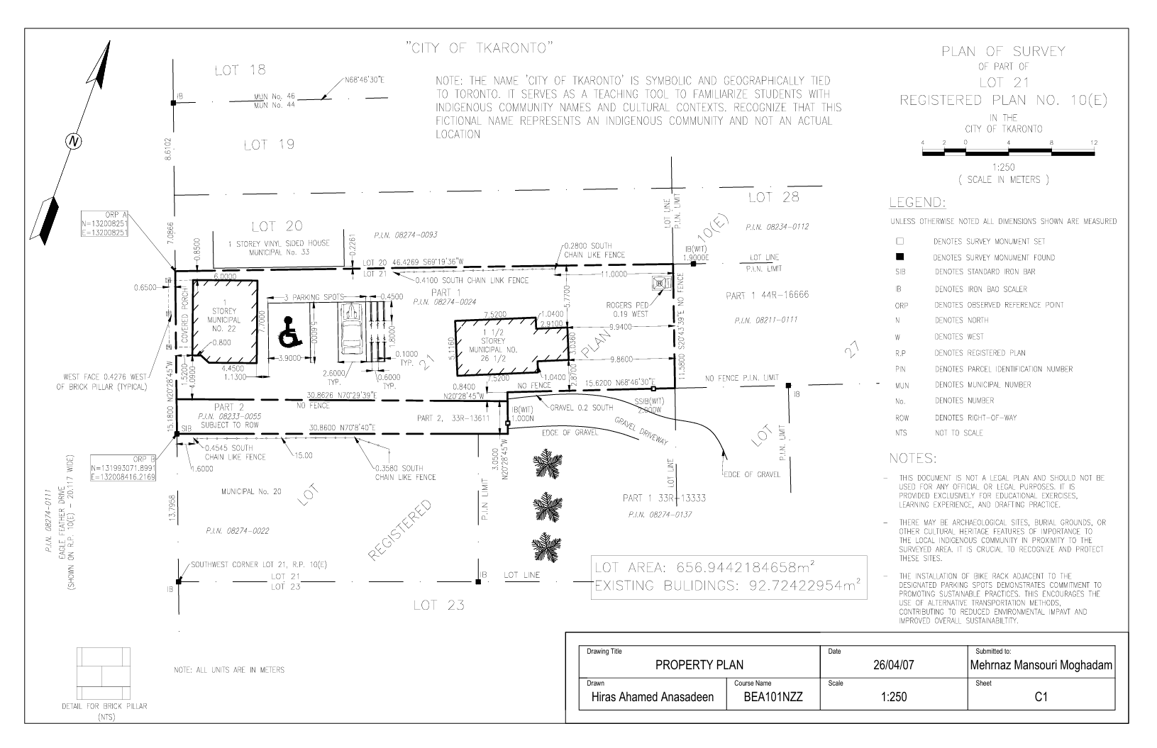
I created a scaled property reference plan covering boundary geometry, structural footprints, easements, survey notation, parking allocation, and cultural heritage notes.
- Context
- Seneca Polytechnic
- Location
- Toronto, ON
- Drawing scale
- 1:250
Total Lot Area
656.94m²
Building Footprint
92.72m²
Drawing Scale
1:250
What I worked on
I created a scaled property reference plan for Lot 21, Registered Plan No. 10(E), covering property boundaries, existing structures, easements, lot area, building footprint, survey notation, parking layout, bicycle rack placement, and cultural heritage notes.
Project brief
My brief was to create a clear scaled reference plan from the supplied project information and survey-related data, with accurate layout, notation, dimensions, and drawing organization.
Technical work
I used AutoCAD for 2D drafting, drawing organization, dimensions, labels, and sheet layout.
I applied scale interpretation and survey notation while laying out the property information.
I organized legends, notes, and cultural heritage information clearly within the drawing sheet.
My responsibilities
I interpreted boundary and survey information to draft the property layout.
I calculated and presented the total lot area and existing building footprint.
I prepared the drawing layout, title block, scale information, notation, and supporting details in AutoCAD.
Project drawing PDF
Anasadeen_Hiras_BA101NZZ_A1-A3.pdf · 0.34 MB